Archive for October, 2020

The Gift Game

Friday, October 30th, 2020

THE GIFT GAME

For the longest time I had a strange notion about hockey. I believed that every so often, usually around Christmas, the players would go for it. Throw the game wide open and go end to end in firewagon hockey. The players would become kids again playing their joyous pond hockey in front of thousands of cheering fans. The fans would see and feel the joy and exclaim “old time hockey.”

The idea of a free, unfettered game was nourished in the 1960’s when games like this actually did occur now and again. The games then only featured the Leafs and Canadiens and their opponents so it may have been a bit easier to convince CBC to yank the shackles than it would have if US interests were involved. But perhaps not. Almost anyone would rather watch wild, free flowing hockey than the constricted pick and shovel games of today. The Stanley Cup playoffs of this year were pretty much a yawn. The first team to score would then clamp the game down as far as they could. This sucked the energy and excitement away. It reminded me of the stifling New Jersey Devils games of awhile back. Especially tedious was the Leafs-Columbus series. The Leafs are about the only team that tries play a go devil game now and it did not work against a choking, stifling defense. It is easier to play the pick and shovel game and safer for coaches to just board up the net than to try and create scoring chances.

What constitutes a good game to me? Speed and rapid puck movement with lots of shots on goal. Not loads of goals but lots of chances , a game like that of December 21, 1968 between the Bruins and Habs. The Bruins had been revived from their doldrums days and had some great talent. Phil Esposito was starting to fill the net and Bobby Orr was rapidly ramping up his game. Gerry Cheevers was in goal and Turk Sanderson was a coming a factor along with established stars like Johnny Bucyk. Montreal, as always had a very respectable club. Jean Beliveau was still strong and their great young defence was excellent. They had a young goalie they had just called up by the name of Tony Esposito who must have had a few butterflies about the prospect of facing his brother on the hallowed ice of the Forum. The game jumped into high gear right away and Phil got a good chance on Tony who snagged the shot

From then on it was non- stop racehorse hockey and the Forum crowd was wild. I watched the game from the old Queen’s Hotel beer parlour in Nelson, BC. I found a quiet corner beyond the range of George Jones and Tammy Wynette on the jukebox and marvelled at the spectacle on the old TV in front of me. Harry Sinden who was coaching Boston said he had never seen two teams go more all out for 60 minutes. Danny Galivan, the great Canadiens broadcaster called it the best all around contest he had seen at the forum in the last ten years.

In 1972, Harry Sinden moved on to coach Team Canada 72 against the Soviet Union. That was a remarkable series fondly remembered by Sinden and most Canadians. However when he spoke with reporter George Vass thirty years later, he insisted that the 1968 game ” was probably the best game from the standpoint of exciting and skilful play, for goaltending, for the fans to see, that hockey’s ever had…. the greatest game I ever saw”.

Right on Harry and let’s see more of them. It’s only been 52 years since that one.

Ted Burns

October 26, 2020


Goodbye Lorenzo

Monday, October 26th, 2020

Remembering Larry Macknicky

It was a warm early summer night in June 1975 when I first encountered Lorenzo. We were having a party at the Beaver Mansion (1837 Fern Street, Victoria). I had invited Ken Lambertsen and his girlfriend Melanie. They showed up for awhile but were soon replaced by their friend Larry. A group of us were sitting on the porch when we saw him dancing down Fern Street with a case of beer. He danced up to the house, boogied up the stairs, placed his beer on the living room floor then danced until the party wound down about five AM. I don’t think he ever touched his beer nor had a dance partner. After that, we called him the Boogie King. Larry was a superb dancer and often attended dance performances like Martha Graham or the Royal Winnipeg Ballet

He lived over on Vining Street and worked on construction jobs in those days and he and I became solid friends drinking in the wild bistros of Victoria, riding our bikes or walking the urban wilds and just hanging out.

I learned that he had a most interesting life but I was never too clear about the days of his youth. He came from the Edmonton area and had also lived in Wetaskawin. I think his dad had remarried an evangelical lady who was somewhat hard on Larry and he became child of the sixties living in a large hippie house he called “Westrold”. His friend Jim Slater called it “ a home for aging children”.

He and some members of the group went to London then pooled their funds to allow one member of their group to travel as far as they could into the Middle East and Asia. Larry was chosen so he took a bus to Lahore, Pakistan. He was a little short of the details of that trip except that it was really hot and dusty. On the way back to England, the bus pulled into a gas station in a little Iran town. Across the road on a similar bus was a friend from Edmonton that Larry hadn’t seen for years. He always marvelled over that.

At about that point, he came to the coast. He lived on Denman Island for awhile and then came to Victoria where he was to spend the rest of his days. This was about 1973. In Victoria, he took about any job he could get. One time, he worked for a logging outfit in the Queen Charlottes (Haida Gwi) as a choker man – one of the hardest jobs in the woods. He was up there for about a week and was unable to set even one choker. The block he was working on was composed of large Sitka spruce that was landing on soft, mossy ground. The crashing logs dug in and were hard to choke. After tossing the choker cables over the big logs, he had to dig under them to pull the choker through and hook it up. Larry was pretty big but was not in shape for that kind of work. After returning from the Charlottes, he worked mainly on construction jobs. I can’t remember even one of them even one of them but I know he didn’t care for construction work. But he sure loved to read and the ideal job for him came along in the 1990’s: the UVIC bookstore. It entitled him to a UVIC Library Card and liberal access to a wonderful expanse of fine reading material. The job also allowed him to buy a small apartment is the Shelbourne- Cedar Hill area.

I was living in Lake Cowichan then but occasionally visited. His apartment was stacked with books floor to ceiling. He favoured history and biographies and was fascinated with Russian history. He claimed that if Trotsky had prevailed instead of Stalin, we would all be drinking socialist beer now. His politics were left leaning but he was a careful student of capitalism. When he was at UVIC, he became the last hippie on the campus. The school had become quite conservative and many students looked like members of the Young Republican Club. Naturally Larry took the opportunity to make a statement with his long hair and old farmer coveralls.

He came up to Lake Cowichan fairly often in the 1980’s. He would ride the E&N dayliner to Duncan then I would take him up to the lake. We mostly drank beer but would sometimes drive the logging roads to Nitinat or Renfrew. After Barbara and I married in the early 90’s then moved to Chilliwack from 1998 until 2018, I didn’t see much of Lorenzo. His sister moved to Victoria and arranged for him to live in an assisted care home and his health started to wane. He didn’t often go out and I don’t think he had many friends besides those in the home. He passed away in May of 2020.

Goodbye old friend. I’ll miss you immensely.

BoogieKing.jpg

LarryatPeden.jpg

Peden Lake in the Sooke Hills

Our Lovely Lakes – Priceless Gifts

Monday, October 26th, 2020

DISTURBING TREND ALONG LAKE SHORES

There is a disturbing trend underway along the shores of many BC lakes and its called urbanization. It wasn’t too long ago that people were content with low impact, small scale development: a small cottage and float with minimal clearing. If you had to access the property by boat, so much the better. Many people of today seem to require more. Much more. It seems that today’s shore dwellers have forgotten how to live in the country because they insist on dragging their city comforts along with them. Power, pavement and houses and lawns that would not look out of place in the Hollywood Hills.

The thought is, if the shore is swampy or brushy or if trees mar the view, bring in machines to create a beach and remove the offending vegetation so trucks can be driven to the water’s edge to haul away any driftwood that dares to land on the property.

If erosion occurs because the shore zones natural defenses have been stripped, bring back the machines to build retaining walls or line the shore with shot rock.

It’s a depressing scene that seems to occur almost everywhere people choose to live by lakes. The Cowichan Lake Salmonid Enhancement Society, a stewardship group in Lake Cowichan recently found that nearly 70% of lake shore properties on Cowichan Lake had moderate to high impacts on the shores. In travelling around the province, I would say as much or more degradation has happened on numerous lakes like Christina, Okanagan, Shuswap, Kootenay Lake’s West Arm – the list goes on.

Shore zones are the most productive parts of our lakes, especially the larger lakes like those I have cited here. The same things that help provide production on natural shores, also attract human activity. Things like protection from wave attack and gentle slopes. These are among the first areas to go.

Is it possible to live on a lake shore without degrading its natural values too much?

I think it is but it requires a dedicated commitment to living light. First off there are parts of lakes that should simply never be developed. They need to remain as nature reserves, parks or rec sites. The portions of lakes that can be in the real estate market place should be subject to constraints like a protected setback from the high water level. Natural vegetation would be retained and a small dock for swimming or sunning would take the place of a beach or lawn. Access would be in the form of narrow gravelled paths.

Perhaps the most attractive feature of BC is its number and variety of lakes. Because of our glacial history and ample water, we have an abundance of beautiful, clean lakes that support excellent fish populations. These lakes are the envy of the world and a priceless gift that must be carefully stewarded . Indeed. The Riparian Areas Regulation was brought in in 2006 to provide a process to determine the protection needs of water bodies. A property owner that wants to build or otherwise develop an area closer than 30 metres to the high water mark of a lake, stream or wetland must have the area assessed by a qualified environmental professional to produce a kind of management report for the parts of the land near water. Keep in mind that following the assessment, it is unlikely that the SPEA or setback from high water will be as large as 30 m. RAR only applies to Regional Districts  and Municipalities where development is thought to be imminent: South Coast and Island , Fraser Valley, Okanagan -Thompson – Shuswap and Gulf Islands, somehow the Kootenays got off the hook but that won’t last long.

Can Nanaimo River Survive Nanaimo?

Sunday, October 25th, 2020

NANAIMO RIVER – CAN IT SURVIVE NANAIMO?

by

Ted Burns

I’m standing at the tip of Jack Point. It’s a cool August night and the lights of Nanaimo are a lovely kaleidoscope to the west. To the east, a full moon is rising over Gabriola Island and the lights of houses are blinking above the bluffs that drop sharply into Northumberland Channel. The only sounds are waves, lapping on the rocks and muffled machinery at Doman’s Mill to the southeast at Duke Point.

Its a calm, peaceful scene but one that belies the reality of Nanaimo; the town with the beautiful name and lovely setting that has turned ugly with its cascading sprawl of suburbia as it rushes hard into the next century.

Nanaimo has long been known as a city without an environmental conscience. Nanaimo River estuary lies just south of Duke Point. In 1971, Nanaimo Harbour Commission wanted to turn it into an industrial port by dredging and paving it. Every biologist in Nanaimo, and there is an impressive number due to the presence of the Pacific Biological Station at Departure Bay, signed a petition that was published in the Nanaimo Free Press. This and public pressure thwarted the Commission and the facility was located at Duke Point. It was the first and last time that many of the scientists at the station came out of their closets.

For many years, Nanaimo was run by a mayor and council that favoured unfettered development. Their vision of prosperity consisted of a series of malls, gas stations and fast food outlets strung along the Island Highway and an endless parade of housing tracts rolling into the hinterlands. Some of them reached as far as the Nanaimo River which is well south of the city. Frank Ney was the Mayor and president of Nanaimo Realty. He was a loveable, good hearted man (Frank died in 1992) but his vision of Nanaimo was strongly coloured by his developer instincts. It wasn’t difficult to get the feeling that town planning was being done by Nanaimo Realty. The Nanaimo Regional District seemed to mirror Nanaimo City Council in terms of their vision of the future.

But Nanaimo is shedding its image as a developers paradise. Recent city councils have been far more sensitive to environmental concerns. They recently passed a stream protection bylaw an environmental protection officer is on staff . Plan Nanaimo, a comprehensive framework for a new community plan, is in the mid-stages of public input. The plan presents a number of scenarios for the future structure of the city. Most of these include an urban containment boundary which roughly coincides with the present limits of Nanaimo. That is superb news for Nanaimo River.

Nanaimo River is perhaps the most beautiful stream on the East Slope of Vancouver Island. It begins in high sub-alpine country near the centre of the Island just east of the Upper Nitinat River and heads west for some seventy kilometres to its estuary dropping some twelve hundred metres along the way. It gathers flow from a number of major tributaries such as Sadie Creek, Green River, Deadwood Creek, its South Fork and Haslam Creek as it tumbles east. Several good sized lakes buffer winter discharge and help warm its summer flow.

Nanaimo River supports chinook, coho and chum salmon in substantial numbers and a few pink salmon and an occasional sockeye. Prior to the mid-fifties, pinks were rather abundant, particularly in Lower Haslam Creek. Runoff from coal mining waste is said to have doomed the pink run. Steelhead are also abundant and sea-run and resident cutthroat trout are also present, particularly in small tributaries of the Lower River and estuary like Thatcher, Beck and Holden Creeks. Resident rainbow trout are present throughout the river and in the lakes and Dolly Varden are resident in headwater portions of the system.

The river is most noted for its chinook and steelhead runs. There is a rather unique spring run of chinooks that begins entering the river as early as March and a sometimes strong fall run that contains some very large fish. Steelhead are represented by a winter and spring run.

Steelhead are the main target of anglers. The river is one of the best steelhead streams on Vancouver Island, usually ranking in or near the top five in terms of catch and effort. Although steelhead can penetrate well into the upper river (some 55 km on the mainstem), most angling occurs in the lower 12.5 km between the Bore Hole and the estuary. In that area, the majority of angling takes place in a 5 km section between the Bore Hole and the Haslam Run near the mouth of Haslam Creek.

Fishing is not the only Nanaimo River recreational attraction; far from it. On warm summer weekend days, as many as five thousand people may be swimming and sunbathing along the river all the way from Cedar Bridge up to the Glade Pool not far below First Lake. Because of the lakes and perhaps because of the large amount of heat absorbing bedrock canyon between First Lake and the highway bridge, Nanaimo River is Vancouver Islands’ warmest. Summer temperatures sometimes reach 25 degrees much to the delight of its’ legion of swimmers.

Although a large percentage of swimmers frequent the Highway Bridge Pool, Pumphouse Pool and Cedar Bridge Pool, many others seek more secluded upstream havens in the rivers’ lovely canyon section. River Terrace, the Old Comox Logging Railroad Trestle area, White Rapids, the Gunbarrel and Staircase, Top Shelf and Bottom Shelf near the old White Rapids mine, Kinnikinnick Canyon, the Goat Trail Pool, Boulder Garden, Golden Fields and White Rocks, Long Rope Pool, South Fork Pool, Quarry Pool, Ocean Spray Pools, Big Bend, Ninebark Pool and the Glade Pool attract an earthy clientele along with a strong showing of the muscle, beer and bikini crowd.

This section of Nanaimo River is its finest and the one that sets it somewhat apart from many other Island streams in terms of beauty. Most of it is reached via Nanaimo River Road and numerous side roads and trails. Some side roads lead to traditional camping areas as well as swimming and fishing spots. All these roads are on private property owned by TimberWest or Island Timberlands. Vehicle access has been cut off due to vandalism and garbage dumping. This is no great loss to swimmers and anglers because the walks are not far but RV campers bemoan the loss of some world class riverside camping spots.

There is a need for much closer management of the Nanaimo River Corridor which extends from the estuary to First Lake. In all that distance (33 kms) through all that beauty and areas of intense use, there is not a single park or recreation area (the closest thing is the Cassidy Rest Stop at the highway bridge). Not a single square millimetre of ground protected from development and managed for outdoor recreation; this seems inconceivable. The corridor cries out for attention and management.

A number of old right of ways parallel the River Corridor. Of particular importance is the Comox Logging and Railroad Grade which is owned by Timberwest. It runs along the north side of the river from the trestle 1.4 km above the Bore Hole to First Lake and, for much of its length, it forms the north boundary of Nanaimo River Corridor. Park dedication of the right of way and the corridor lands south of it including lands on the south side of the river, would be a major step toward giving the river the attention it deserves. A number of smaller parks or recreation sites could be established downstream at places like the Bore Hole, Forestry Run, Haslam Run and Thatcher Creek – Morden Park Area and a special zoning status should be applied to the corridor outside the parklands to insure that no more development invades land that rightly belongs to the river not the real estate market place

.

SOME EARY BURNS DAYS IN CANADA

Friday, October 9th, 2020

Early Days of the Burns Family in Canada

In the early autumn of the year 1878, three young Scottish tradesmen born and reared in the City of Glasgow encouraged by glowing descriptions about opportunities in North America and discouraged by the lack of opportunity in their native land, decided to emigrate to Canada. They sailed from Glasgow to Quebec. The steamboats of that day took about three weeks to make the trip from the River Clyde to the St Lawrence.

The three youngsters were all in their early twenties. They were:

  • John Burns
  • Walter Leitch
  • James Macalister

The first two were Master Joiners and Foremen Carpenters and Maca

lister was a Master Stone Mason. Each has served apprenticeships of seven years.

Burns and MacAlister were married and each had three small children, the youngest a babe in arms. Walter Leitch was single but hoped to have a future wife join him in Canada.

Winnipeg was booming and was much advertised in Scotland. It was the proposed destination of the boys. You travelled by rail to St Paul, Minnesota then by stage to a landing on the Red River. There a small steamer went on to Winnipeg and Fort Garry. This was a long, hard trip through unsettled lands where hostile natives were sometimes present.

The first leg of the trip was from Quebec to Toronto where the young men were persuaded to drop Winnipeg and go on to the Parry Sound District about 200 miles north of Toronto. Settlers could obtain a grant of 160 acres there. At that time Gravenhurst was the end of the Grand Trunk Railroad. A stage ran from there to Parry Sound on the shore of Lake Huron’s Georgian Bay. At Parry Sound they were directed to take another stage to a small hamlet called Dunchurch some 27 miles to the north and located on a narrows between two lakes called Whitestone. They eventually took up lands on the Whitestone River 12 miles from Dunchurch. The land was heavily timbered and filled with game and the river had good edible fish. The Scots were all good riflemen and after they built a cabin for the winter managed to get by with what they could purchase, shoot or hook. The grant lands were taken up in the winter when there was considerable snow. It wasn’t until the spring melt that Burns and Macalister found that they had located on stony land not suitable for growing things. Agriculture was essential to the new settlers in a land where food supplies could be difficult to come by and expensive to buy. Leitch had better luck and his land became a productive farm.

In April of 1879, the wives and children of Burns and MacAlister arrived in Canada. John and Anne Burns had three boys:

  • Robert b March 1875
  • Harry b December 1876
  • John b August 1878

They took the train to Gravenhurst where they were met by the husbands and fathers who took them to the rough quarters at the pre-emption.

John Burns went back to his trade as a carpenter. He built a small hotel at Dunchurch. He and his wife operated it for a few years. The old country tradesmen of that period came prepared so Burns had brought a fair stock of tools. There was no woodworking factories near so most of the wood work had to be made by hand. Lumber was whip sawed and finishing was done by hand plane.

About two years after his arrival, John Burns built a small sawmill. It was steam powered and consisted chiefly of a circular head rig and a carriage. Logs were brought in by sleigh in the winter and by water in the summer where they were stored in a boomed off pond. The mill only operated when lumber was needed. Both lathe and shingles were made but there were no planers to dress the lumber. Good clay and lime were available so bricks could be made. Most buildings were log with stone foundations.

Macalister with an increasing family found it hard to make expenses so after a few years he moved to Parry Sound where he worked as a stone mason. He then moved on to Edmonton when the railway reached there and I lost track of him. His oldest daughter moved to Moyie where her husband was the superintendent of the St Eugene Mine until it closed down. This lady used to visit my mother in Nelson regularly before she left Moyie.

Walter Leitch who had the only good land managed to get a fair acreage under production. The logging camps provided a good market for his produce. He carried on until he got too old then moved to Toronto,

Parry Sound was well timbered with White ad Norway pine and fair stands of hardwood like maple, oak, birch, beech and ash and elm. There were numerous lakes connected by creeks and driveable rivers and this was very helpful getting the wood to market. In my very young days, white Pine was taken out as square timbers for shipment to Britain. Later on, the logs were floated down to Lake Huron then towed to mills on Georgian Bay or across the lake to Michigan mills.

Very few settlers in this district were able to make a living from their farming operations. Some add to their income by trapping. There is an abundance of fur in the region. Others work in the logging camps and on the river drives. Good mink, marten and Red Fox skins sold for a dollar and muskrats for 10-12 cents each. Beaver and otter are worth more but a lot of skill is required.

The three Burns boys all grew up in these surroundings. All had Scottish accents and wore clothes from the home country. Life was rather tough because of their speech and kilts. They soon lost their accents and clothes. Their parents never lost their accent. The boys attended a public school which also served as the church and recreation hall. The flooring, doors, windows and desks were all made of whip sawn White Pine smoothed with a jack plane. Volunteers built it all. The teacher was an old fashioned English school master (Thomas Butler) who taught the basics. He was good teacher and many of his students owe their start in life to his solid grounding taught in that little log school house. The majority of his students never got the opportunity to go further because there was no high school. But when Mr. Butler was through with them, they were well equipped to take their places in business life.

Boys of that era grew up early and had to learn to do things for themselves and assist their parents. Times were hard ad money was scarce. A boy of twelve was supposed to be able to do most of the work around the farm as well as attending school. The Burns were no exception. There were farm duties along with the sawmill and a livery and freighting business. At an early age the boys learned to be all around loggers, river drivers and sawmill men. They could drive a two or four horse team and handle any kind of boat in almost any kind of water. They could shoot, trap, hunt and snowshoe as well as any of their young Indian friends.

Summer recreation was canoeing, fishing, swimming and riding with some sports thrown in. In the winter, there was sleigh riding, snowshoeing and tobogganing. Our father had brought a pair of skates from Scotland so we were able to skate on the lakes. The skates consisted of a wooden base that the shoe fitted on. It had a screw on the rear that fitted into the end of a regular shoe and a skate blade fitted on to the shoe. There was just the one pair of skates for the three boys. Later on, cast iron skates were available but these were easily broken and not very popular. Finally, spring steel skates were made that clamped on to the sole of the shoe and tightened with a spring. These were much more convenient. The Indians wore deerskin moccasins so they clamped the skates to pieces of wood shaped like foot soles and cinched them tight with deer hide thongs called babiche. The natives could race with these skates but the white boys needed more ankle support especially on rough ice. (Uncle Harry was an avid hockey fan so perhaps this is why he goes into such detail on the skates of the day. I’m thinking that hockey wasn’t yet played in this part of Ontario. The time period he is speaking about would have been about 1885, Hockey historians seem to have agreed that the first games were played in Montreal around 1875. It is interesting that a similar game called shinty was played well before that in Scotland. When I was a boy, our pickup games on the ponds or on the street with tennis balls was called shinny)

There were plenty of square dances with sleigh parties. Music was supplied by accordions or fiddles.

The boys were all good swimmers, canoe men and riders. Their Indian friends made them bows and arrows, sleighs and toboggans from local hardwoods as well as birch bark canoes and snowshoes. They also supplied pants and gloves. Almost nothing was imported or made in a factory. The guns were mostly muzzle loaders from the old country.

The Burns boys were lucky to live near an English family with a library and a liberal lending policy. Grimm Fairy tales Robinson Crusoe, Rip Van Winkle and Arabian Nights were among the titles. Mark Twain had just published Tom Sawyer and Huckleberry Finn. These were greatly enjoyed on stormy winter evenings. The local boys were good campers and tried to imitate the Twain characters by floating on rafts and living off the land. Fish and berries were the main staples. Fish were cooked by rolling them in wet clay and baking them in campfire coals. Bass and pickerel were common and little equipment was needed to survive in the summer.

This was a way of life for youthful Canadians of the countryside. It made them resourceful, self reliant and healthy. When their time came for them to go out on their own, most were ready.

Logging Camps

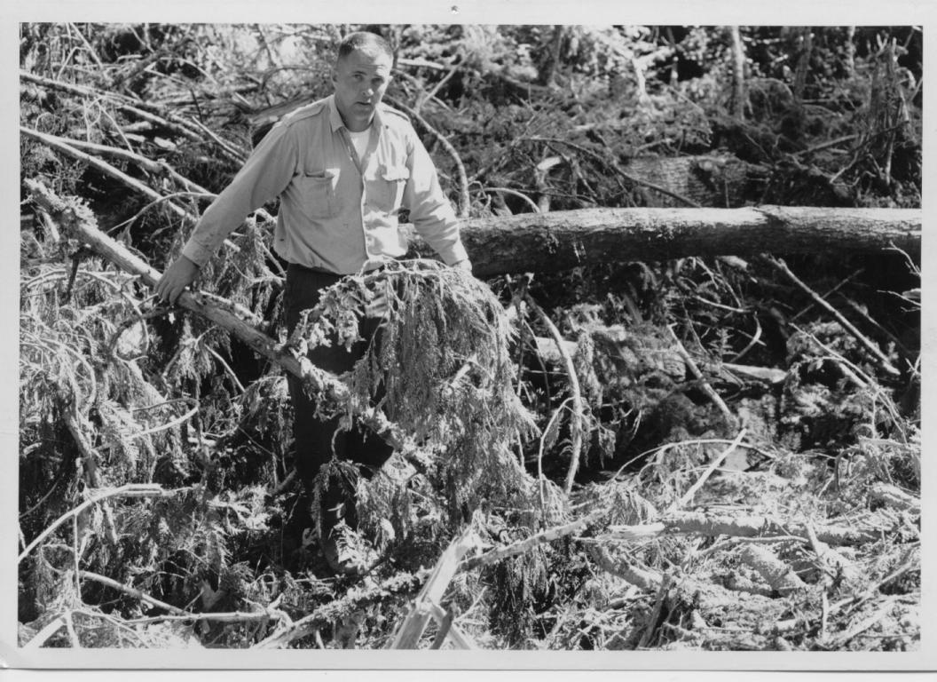
Accommodations and food were very rudimentary for loggers and drivers in the late 80’s and 90’s. Conditions today are simply not comparable ( Uncle Harry was a logger all his life and owned and operated camps in Ontario and BC so he knows of what he speaks). Very little time was spent trying to provide comfort for the workers. Building walls were made with sometimes flattened insides and bark on the outside. The cracks were chinked and moss and often with a mixture of clay and a small amount of lime. Roofs were covered with logs of a uniform size flattened on one side scooped on the other in alternating fashion. The scoop roofs were designed to carry away water. The floors made of poles flattened on the top side with an adze to make them easier to walk on and sweep with the brush brooms of the day. They were seldom washed. The large building was heated by an open fire in the centre. There was a large opening in the roof which carried off the smoke and provided ventilation. The sky was visible in daylight. This fire was called a Camboose and all wet clothes were hung around it to dry on pole racks,

The bunks were made of small poles and were called Muzzle Loaders. They were all two bunks high and were entered from the foot because they were so packed together there was no room on the sides. Wool blankets were supplied but there were no springs or mattresses. The bottom of the bed was covered with cedar, spruce or balsam boughs or, if you were lucky, hay. As many as 50 men slept in a building and it was lighted by candles or coal oil lamps. The cookhouse was constructed the same way and was usually next to the bunkhouse. The space between them was sometimes covered to provide a covered walkway and storage space. The early camps had no stoves and cooking was done with bake kettles covered with coals or sand and assisted by a reflector or Dutch oven where pastry was sometimes prepared, an experienced cook was needed. But I have had first class meals cooked by the simple method.

Game was plentiful in the Parry Sound and Nippising area and in the 1880’s and early 90’s, it was customary for a camp to have a designated hunter on staff. He shot deer and used their tanned hides for mitts and clothes. He was paid 3 cents per pound for the meat and sold the other items to the camp. He was carried only in the cold weather between October and April so the meat would stay safe. The other supplies provided by the camps were flour, white beans, dried apples, mess pork and corned beef. There was also long, clear bacon called sow belly. No butter, milk, sugar or vegetables were supplied after freeze – up. Syrup was handy however and supplied in barrels.

In my early days in the camps, White and Norway pine were the only trees taken. They were logged with axes and the fallers were called Choppers. The pines were cut 10 feet above the butt. The butts were left to provide Shake. The White Pine was made into square or Waney timber for the British market and the Norway pine went to local mills.


About this time, cross cut saws came into use and trees were notched and felled

As they are now. This got rid of the system called Long Butting and saved a lot of clear wood.

Timber from the Baltic countries became popular in the British market and could be delivered for less so Canada had to look for other markets. A large portion of the cut went as saw logs then they were hauled by horse and sleigh to the lakes and rivers to wait for break up. They could then be floated to Lake Huron and find their way to the large mills in Michigan in places like Saginaw, Bay City and Alpena.

Logging was about the only industry in our district and about the only thing the boys could look forward to was a foreman or superintendent’ job. Or perhaps a manager if they picked up some education. Before they were too old.

Robert and Harry Burns were, like other boys loggers and river drivers when they were fifteen. Both became straw bosses or deputy foremen when they were very young.

Robert Burns, after a short time in BC with his father and brother John decided on a mercantile career and bought a small country store near Orilla. He later moved to Manitoba and Saskatchewan winding up with a general store in Humboldt where he died in 1928.

John was interested in building, and , after a few winters in the woods he worked with his father eventually going with him to Nelson, BC where they constructed several important buildings. John Burns Senior died in Nelson in 1916. His son carried on with the building business for many years building many outstanding buildings in the Kootenay Region. Among them is the Nelson Post Office later City Hall then Touchstones, Court House Canadian Bank of Commerce, Central and Hume Schools and Government Buildings at Rossland, Trail, Greenwood and Grand Forks as well as Court Houses at Vernon and Kaslo and the Greenwood Post Office.

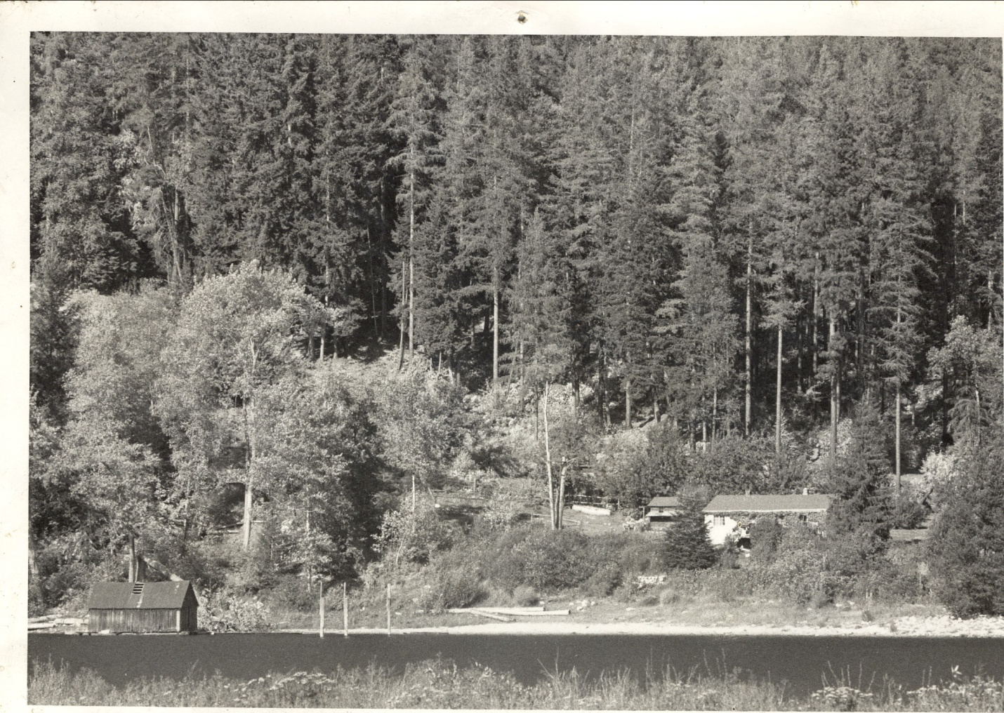
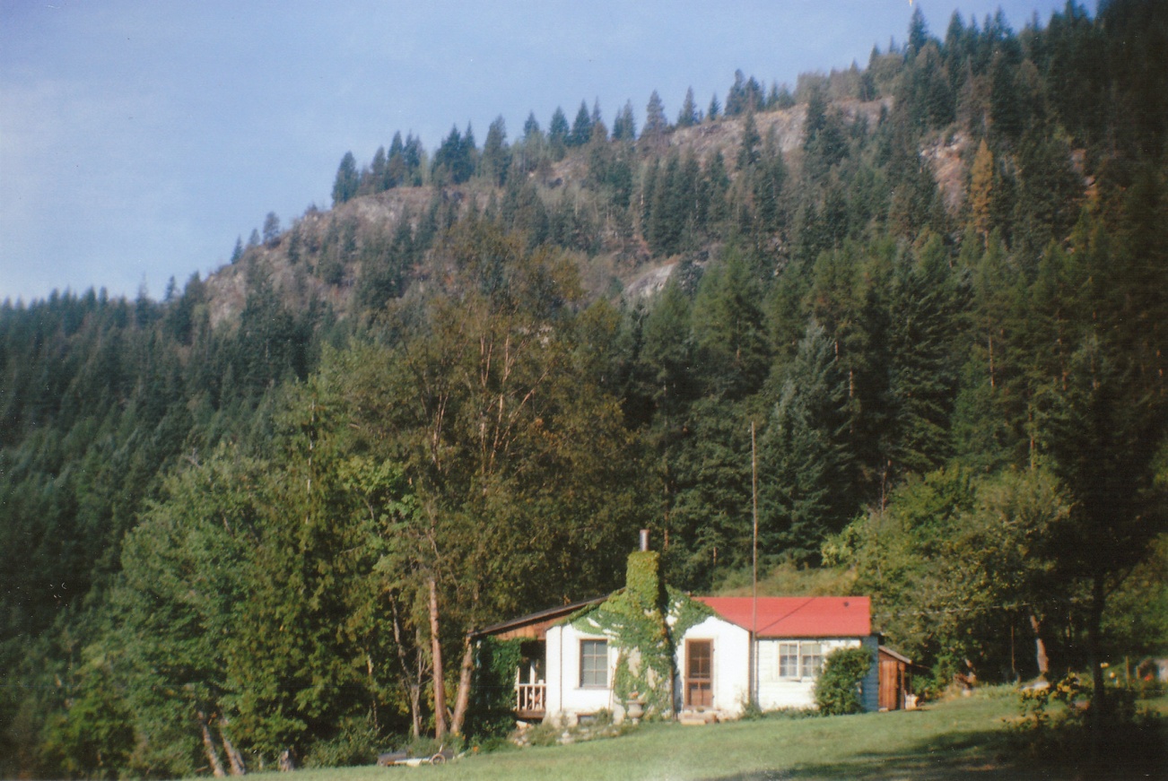
. Also the Nelson Brewery, Mara and Bernard Block, St. Josephs School, a number of private homes: 411, 415 and 413 Carbonate, the old hospital on Front St and The Malone House at 1102 Front St. He also built the old fire hall. In about 1920, he constructed the hotel and pool at Ainsworth. He bought much of the township of Ainsworth and built the cabin at Loon Lake. In 1928, his firm had 80 employees, owned a sash and door factory, lumber yard, the gravel pit behind the high school and several marble and rock quarries. His last job was construction of Nelson’s Civic Centre a multi use public building with an area, recreation hall, theatre and library. It was built in the midst of the depression. He was a Nelson alderman in 1918-19.

Harry Burns stayed with the logging and lumber business. He took a course at Ontario Business College and parlayed that and his experience as logger, river driver and timber cruiser into management positions at Georgian Bay Lumber Company and Blind River Transportation Company where he was involved in both logging and railroad construction.

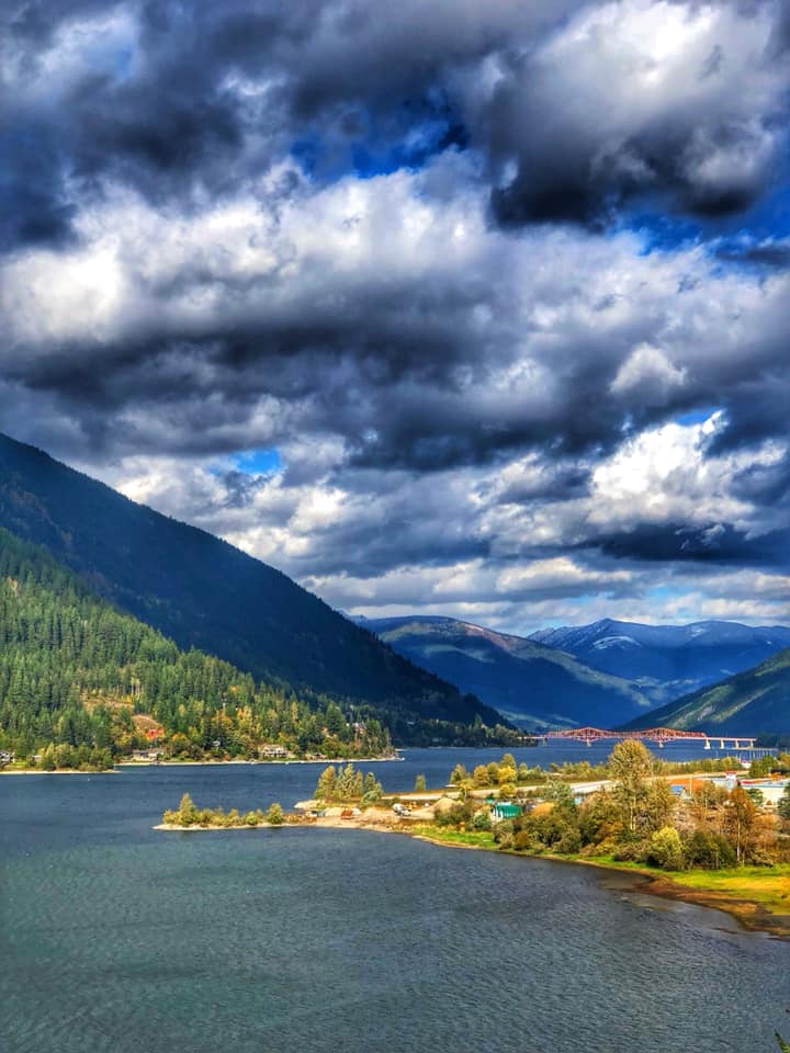
By 1906 however, Harry got an itch for new country. His parents and brothers had moved to nelson in the 90’s going in by Spokane and the Nelson and Fort Sheppard Railway. (later called the Great Northern and Burlington Northern)

The CPR Crowsnest Line was still under construction.

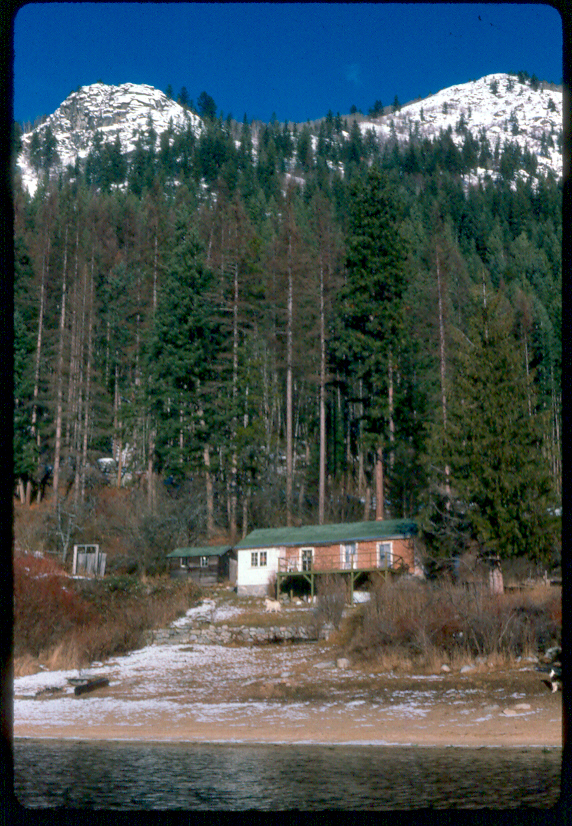
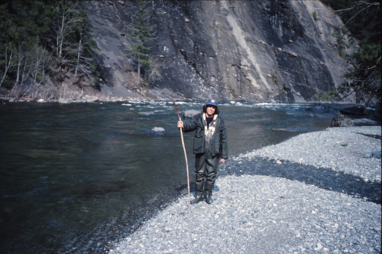
Harry was immediately offered a job with Western Canada Timber Co. at Gerrard, BC as assistant superintendent in charge of all logging. The timber was thick and easy to get out. The Gerrard town site was cleared and a new mills with a capacity of 110,000 feet a shift. A few very nice dwellings were constructed. Logging was done around the Gerrard Town site, at Poplar Creek and American Point Four Miles up Trout Lake. CPR ran a steamer from Nelson to Lardo three times a week and a train ran up the Lardeau Valley to Gerrard where a steamer (SS Proctor) continued to Trout Lake City. He also served as post master for Gerrard.


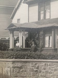
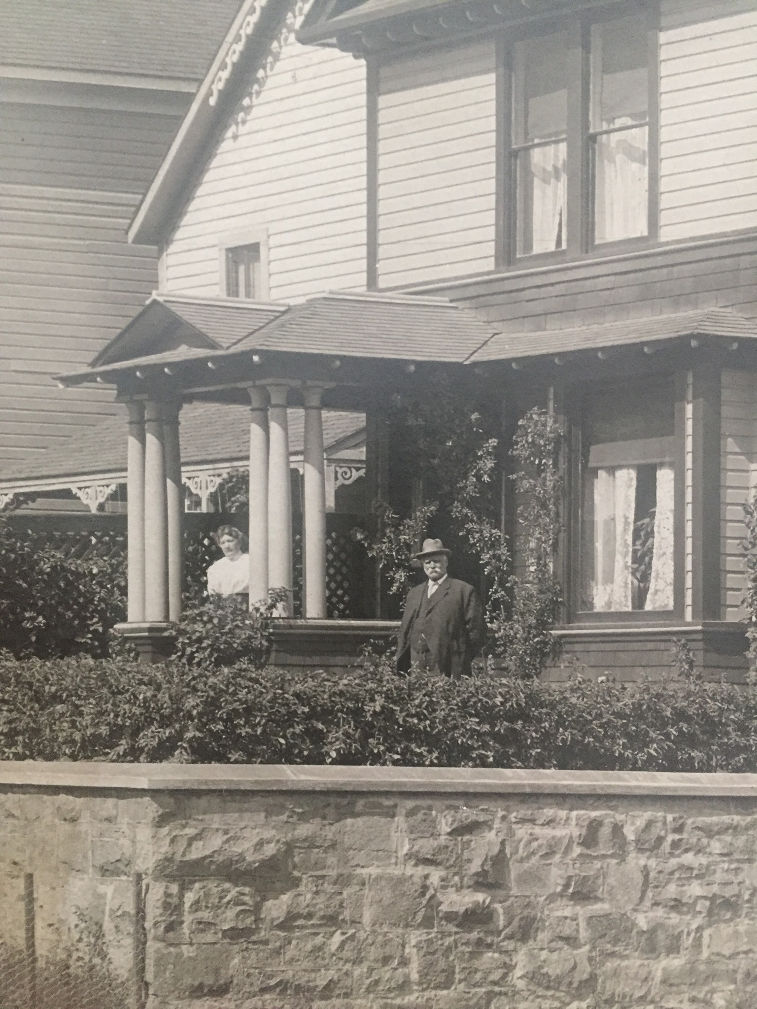
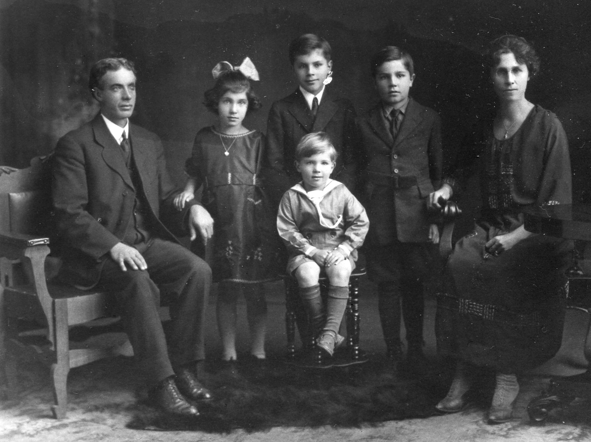
The First John Burns with wife  Annie at 423 Silica Nelson about 1900

After this operation Uncle Harry worked in Vancouver for North Vancouver Sawmills and Cascade Wood and Coal. On the coast he also helped survey the boundaries of Strathcona Park, and owned part of West Vancouver. Back in the Interior, he had a mill and logged near Taghum then operated Tree Farm Licence #3 at Passmore in the Slocan Valley with his son Gordon. They also had a building supply store at 602 Baker Street in Nelson where his other son Bill was employed. He was a life member of the Kootenay Lake Hospital Board and the Nelson Chamber of Commerce.

Written By Harry Burns

Edited by Ted Burns (August 12/20) and supplemented by John Burns No. 4


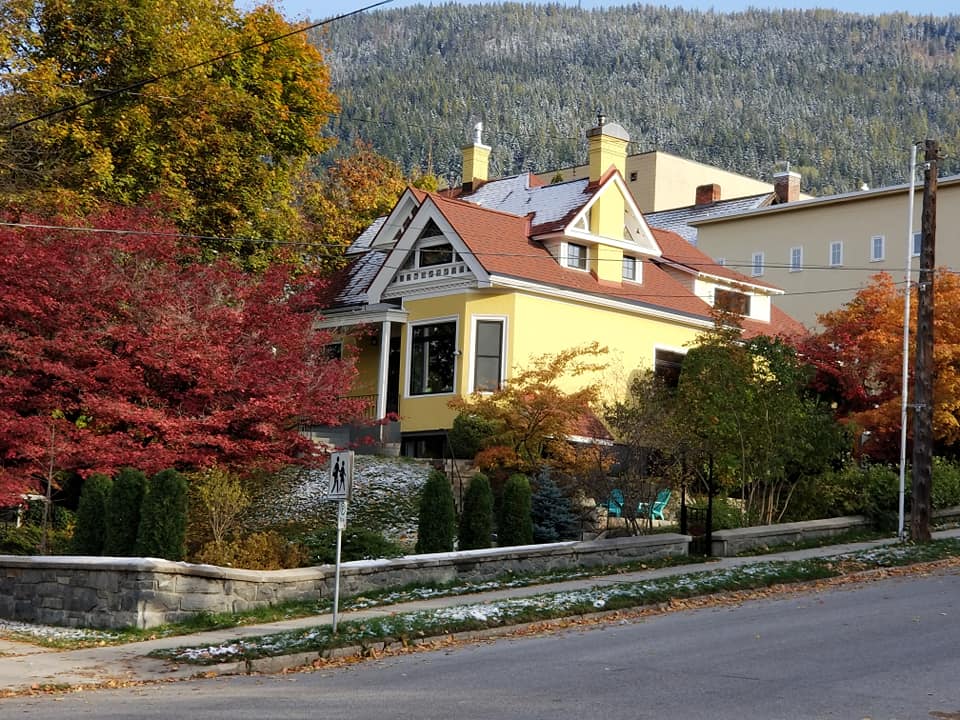
Harry Burns Nelson house at Carbonate and Ward. Later owned by Littlewood then Bruce Ramsay

Coastal Cutts

Friday, October 9th, 2020

Coastal Cutthroat Trout in BC

The coastal cutthroat trout is often termed the “native “trout of the northwest coast because it is so well adapted to the wide range of aquatic environments in this region. Cutthroats occur in nearly all coastal streams from Southeast Alaska to Northern California, from tiny pastoral creeks to large, turbulent rivers. They also occur in the big lakes and most of the little lakes and ponds and they are no strangers to estuaries, beaches and bays along the coast. Wherever they are found, coastal cutthroats are among our most interesting and popular sport fish.

They are handsome fish and are usually not difficult to find or catch in lakes, streams or the sea provided anglers know something about their habits in the area they are fishing, Complex tackle and large boats are seldom required. Just a light rod, some waders and a handful of flies or small spoons and perhaps a small boat.

cuttie.jpg

A Big Qualicum sea – run.

GENERAL DESCRIPTION

Size and coloration depend largely on the home environment. Sea run cutthroat may attain weights of 2 – 2.5 kilograms with the average being closer to .5. Larger sea runs occur but I have never seen one and they are said to be rather rare. Immature fish are green to metallic blue on the dorsal surface and upper flanks. In one area I fish a lot which is well inside a large estuary protected by a barrier beach, fish that stay mostly in the estuary and lower river, are highly colored while outside fish that patrol the beach are silver bright.

As spawning season approaches, they start to take on a lemon yellow to brownish tinge and the characteristic paired slash marks on their lower jaw become a vivid orange or red. Maturing sea runs are often called yellow bellies. Coastal cutthroats are usually more heavily spotted than steelhead, resident rainbows or the Westslope Cutthroat of the Kootenays.

Lake residents vary considerably in size. In large lakes which contain other fish like rainbows, kokanee or sockeye and forage fishes like sticklebacks and sculpins, they grow quite large. Lakes like Cowichan, Sproat, Buttle, Powell and Owikeno can produce some giants. A seventeen pounder was caught in Sproat in 1957. But the cutthroats in the many smaller lakes and ponds seldom attain much size and often over populate the lakes. Like sea runs. Cutthroats in coastal lakes are usually silvery as immature fish but coloration increases with maturity. They often have a pink rainbow like tinge on their flanks. The two species sometimes interbreed in lake tributaries and it is often difficult to tell their offspring apart.

Many coastal streams have cutthroat populations that live out their lives in a few pools in headwater reaches. Conditions are often harsh there and the little trout are hard pressed to attain sizes of 15 – 20 cm. However, the little stream dwellers are among the most beautiful and interesting members of the trout and salmon family.

coloredcutt.jpg

LIFE HISTORY

Sea run cutthroat are found in nearly all BC coastal rivers but they do best in the small streams. Young cutthroats are shy and non aggressive. When they compete with young steelhead and coho, they avoid conflict by living in less favorable living spaces. Fortunately, there are substantial coastal lowlands laced with small streams ideally suited for cutthroat. These little brooks are often more diverse in habitat and richer in food organisms than the lager creeks frequented by the more territorial salmonids.

A few sea runs begin entering some of the larger rivers with the early pink and sockeye which can start in July. These are not true spawning fish, they are just tagging along to feed on loose eggs or insects stirred up by salmon spawners. A few weeks later, some cutthroats begin to head upstream for their spawning. In many of the smaller creeks, the cuts will not enter until the persistent fall-winter rain fires up which can be as late as December. The spawning period therefore usually last from December to March. These fish are notorious for their lack of attention to calendars. I have seen them in spawning behaviour from November to May.

Most sea run cutthroat spawn after one or two summers in salt water and one to three years in freshwater as juveniles, as spawners they range from two to five years in total age. Smaller streams are usually preferred and the fish seek out a gravel riffle near cover where the female excavates a red with strong tail flexes and males settle in and deposit sperm. Spawning rigours are less than those of steelhead so some cutts survive to spawn again. The fish drift back to the estuary later in the spring to regain their strength.

For the product of their effort, life begins as a pocket of eggs buried in the gravel. Only a small portion survives the perils of winter. Sometime between April and July, the fry begin wiggling up to begin stream life as 25mm fish. They seek out gentle current by the stream margins. Quiet vulnerable now, they have to dodge a host of predators like birds, snakes and larger fish that eagerly wait to dine on small trout. AS the water warms and the food supply increases the little fish gain growth and move into mid stream and try to defend a territory. They prefer to live in pools but if the larger and more aggressive steelhead and coho are present in sufficiently large numbers, they are pushed into less favourable riffle habitat to live, If there is no riffle habitat because of poor stream structure or extremely low summer flows, most young cutthroat are fated to die. In the fall of their first year of stream life, the remaining young cutthroats are from 5-8 cm long.

As fall advances, streams cool and flows begin to rise, the young fish move back to quiet water to seek winter sanctuary. Favoured resting places are side channels, deep pools, log jams, adjacent riparian ponds or wetlands and the undercut roots of streamside vegetation. The small fish do little feeding or even moving around in winter. There is little food to be had and the cold water makes the fish very lethargic. When spring finally arrives the survivors are thin, dark and weak.

Spring is a time of revival in streams and the young trout are quick to regain their strength and vitality in the warming, energy rich water. Fish that seemed barely alive in March are now healthy and active. Some of the more vigorous are able to double their size in the spring and early summer months. In some of the more productive South Coast streams, some fish are now large enough to smolt and head for sea. Most will remain for another year or two.

The larger young trout that remain in the stream, can seek out pools now as their summer habitat. They are now larger than young coho and are free to choose their living space without interference. In many small streams, the riffles are too shallow to support the fish. Some streams even become intermittent in the summer and early fall and the pools provide the only water. The cover and shade provided by streamside vegetation, logs and boulders become important survival factors. When winter returns, the fish again seek out shelter and with the onset of spring, the fish begin to feed ravenously and up their size to 12 – 20 cm. Then, late in April or early in May under the cover of darkness and the murky water of spring freshets, the fish move down to begin a new life in the sea.

When the trout reach saltwater, the trout do not adapt the wanderlust of steelhead and salmon.

Far from it. Hey are content with the bounty of estuaries and the shoals of nearby beaches and bays. They seldom stray far from their home stream – to the delight of anglers – and are happy to dine on the local smorgasbord of small fishes, shrimp, sand worms and larval forms of marine life.

Cutthroats grow rapidly in the ocean environment and at the end of their first ocean summer many have added 8 – 12 cm of length and have grown from 55 to 270 grams. In the fall and early winter, all cutthroats return to their home stream though not all spawn. Some males are sexually mature after their first summer of ocean life but most fish spawn after their second saltwater summer. The reason cutthroats do not grow as large as steelhead and salmon is that most spend only three to five months at sea each year. While they may live longer and spawn more often than steelhead and salmon, they spend a much larger portion of their lives in streams spawning and overwintering – tough times They seem to have a keener instinct for getting on with the job of survival and an ability to make the best of what nature offers them. This has gained them loads of respect among anglers and biologists. Indeed.

Coastal cutthroat in lakes exhibit a somewhat similar life pattern to sea runs. Spawning and early development occur in the tributary streams before the trout move to the lake for faster growth, mature and return to the streams to spawn. Major differences are most young migrate to the lake as yearlings and in larger lakes with a good food supply they may grow much larger. They live longer in the lakes before returning to the streams to spawn.

Surprisingly, cutthroats in lakes have been shown to make lifestyle adjustments when competing salmonids are present, much the same way they do in streams. When rainbows are present in roughly equal numbers, the more aggressive rainbows dominate the surface and upper zone of the lake where they feed on zooplankton and insects and do not grow large a three or four pounder is a prize. Cutthroats are more oriented to the bottom where the food supply is generally much richer and the cutthroats make better growth than their upstairs neighbours. Rainbows are usually only naturally present in the larger lakes. The rainbows that are present in many of the small lakes in populated areas are stocked hatchery fish. Cutthroats are better suited for all lakes but hatcheries have a hard time finding reliable brood stock. Because they key on fish when they grow bigger, some become quite large.

When cutthroats share lakes with Dolly Varden, it’s the Dollies that take the bottom. Dollies are not common in south coast lakes. They are a very cold water fish and the southern lakes may be getting too warm. They are more numerous in north and central coast lakes where glacial runoff keeps waters cold.

When cutthroats have lakes to themselves and good spawning streams are present, they tend to overpopulate and seldom become large.

THE FUTURE

In some ways, cutthroats have become the forgotten fish of the coast. There has been bursts of hope with the implementation of the Salmonid Enhancement Program (SEP) and its public involvement initiative. Fish biologists have long known of the manageability of the small stream environments of the fish. These small streams are often easily improved by such measures as headwater storage, structural improvement of habitat features such as cover and spawning gravel. Because the fish stay close to home in their ocean phase instead of wandering the sea subject to commercial fisheries, cutthroats are more manageable than steelhead or salmon. The SEP public involvement program has spawned a multitude of stewardship groups that have taken on a lot of the management and protection tasks for the small streams.

But the little creeks are also easily subject to harm and as quick as they may be to respond to a helping hand, they can just as soon suffer from careless land use practices. A lot of effort has been spent trying to educate people on the sensitivities of small streams but there are still significant issues where private land development brushes up against a common property resource and people may actually own the stream bottom. The regional stewardship groups are working hard in their communities to make sure people know about the cutthroat creeks and respect their needs.

In the 1970s, I worked for the BC Fish and Wildlife Branch on Vancouver Island out of Nanaimo. One of my colleagues was Gordon Smith, a wildlife technician and Nanaimo native. He often told me about his grandfather who fished the local streams often for “trout” and usually made great catches. This must have been in the 1920s or 30s. Steelhead fishing was practically unheard of. The streams Mr. Smith fished were still in Nanaimo but there were few or no trout left. Cutthroats are disturbingly susceptible to over fishing because they are so easily caught. I have heard of early days anglers catching dozens in a few hours of fishing. Regulations must be extremely conservative. I think only barbless flies should be used and all fish carefully released. It is only by protecting and improving habitat and not killing any, that cutthroats will return to their honoured position as the Native trout of the BC coast.

bucktails.jpg

A selection of sea-run cutthroat flies that imitate small fish. Note that they are not barbless.

Ted Burns

August 11, 2020

Original version published by the BC Fish and Wildlife Branch in 1981 with art work by Jack Grundle and photos by Ron Ptolemy and the BC Provincial Museum.

Remembering Muggs

Friday, October 9th, 2020

Remembering Muggsy Holmes

Monral Boyd Holmes died on November 10, 2018 – he was 75. My old Nelson gang is getting very sparse these days -not many left. Like many of us, Mugs hadn’t lived in Nelson for years. He was living in Olalla, a conglomeration of trailer parks and small farms near Keremeos, when he passed away. Before that he had been on the coast mainly working in sawmills. Tahsis, Victoria, Shawnigan Lake, Port Alberni and Ladysmith. He tired of the rain and went to Olalla to get away from it.

It must have been around 1953 when Mugs and I first met as Nelson boys. Fishing was what interested us the most and we spent lots of time prowling the local spots like the City Wharf, the City and Walton’s boathouses and the mouth of Cottonwood Creek. I can especially recall the good days we had at Cottonwood. It’s so different now that the dump, landfill and air strip have overtaken it and messed up the area around it where there was once Chinese Gardens, a sawmill, skating ponds and a hobo jungle.

We started fishing at low water in the early spring where the drop off to deep water was right at the creek mouth. We used worms or stonefly nymphs that we carefully threaded on small bait hooks. We attached one or two small split shot sinkers and fished “ Muggsy style” letting the bait out as natural as possible. Mugs was truly an expert in thinking like a fish. He imagined that the Cottonwood rainbows were poised just over the drop off waiting to sample any thing that came along in the creek outwash. But it had to look right or they would pass up. So we cast upstream a few meters into the creek and let our bait kind of roll down the drop off in a most natural way. Mugs was right. We caught fish and some real good ones – hard charging rainbows to four pounds. But boy were they fussy. We would feel frequent electric taps as the bait worked down the drop off face. The temptation to set the hook was strong but by the time you jerked, the fish was gone. You had to wait until the fish hooked themselves or swallowed the bait. It was hard to resist the bites but eventually we landed a few.

Later on in the spring and summer, we fished from my granddad’s little boat around the Nelson waterfront and caught lots of silvers in June when the water was up. I remember how Mugs used to piss me off by repeatedly spitting in the boat. “You have the whole lake to spit in so why spit in the boat”? Grandpa Burns was a stickler for cleanliness and I was sure we would lose the use of the boat. But he helped me wash it out and no one was the wiser.

The other thing Mugs and I shared was music. I had just been given a guitar and was taking lessons. Mugs was a natural musician and scoffed at my lessons. He had an older guitar and could play it well. He knew all the popular songs of the day: Elvis, Bill Haley, Eddy Cochrane and could imitate Elvis to the tee. In later years he performed as an Elvis imitator and played in a band that did all the old tunes. I used to have an LP of Mugs and his band but lost it.

Mugs dad died in 1954. He was hit by lightning near Kaslo. So his Mom was left with Mugs and his older brother Don – two lively and rambunctious boys to feed and nurture. She worked two jobs to keep the lads going and it must have been tough. She was a maid at the Hume Hotel and a ticket agent at the Civic Arena. She was very protective of her boys and if Mugs and I were late getting home she was on the phone immediately “Burns, where’s my boy”? Mugs could look after himself and if he ran into something or someone he could not handle there was his brother Don who was feared around Nelson.

I left Nelson in 1958 and Mugs and Don left not long after – Mugs to work and Don to play hockey. It was quite a few years before I saw Mugs again. I had written a fishing story for BC Outdoors. Mugs saw it and called the magazine to get my address in Lake Cowichan. From then on we resumed our adventures but this time on t he Island. We fished at Cheewhat and Sprise Lakes and the Nitinat River where we dodged black bears to land some big Chinooks. We also fished some lakes around Port Alberni when you could still get into the woods around there. We were looking forward to fishing some of the productive small lakes in the Okanagan Hills but left it too late.

Cheewhat.jpg

Mugs at Cheewhat Lake.

Toylaker.jpg

Mugs at Toy Lake

THE RANCH

Friday, October 9th, 2020

BURNS POINT

THE RANCH

There was a time back before the wars when there was an effort to start fruit ranches on the hills around suitable spots on Kootenay Lake. Even before the Okanagan orchards began, Kootenay pioneers started to propagate fruit

The first white settlement on the North Shore across from Nelson began around 1890. Newlin Hoover owned all the property between the bluffs across from the mouth of Cottonwood Creek up to the James Johnstone Ranch. In 1903 he swapped five acres to J. Fred Hume so he could construct two lovely houses on it along with tennis courts and grape vines. Hume called this property Killarny on the Lake. Hoover lived in a brick powder house on what came to be called the Hoover Ranch then Burns Point.

Oldranch.jpg

In 1926, John Burns bought the ranch from Hoover or Captain McClian who may have owned the property ranch after Hoover.

The house had to be upgraded by adding two bedrooms, a bathroom and a porch. Access was by boat only. A road was far in the future. Grandpa Burns refurbished an old house on the Nelson side to park vehicles and store equipment. He maintained good boathouses on either side so crossing over was relatively easy. The family usually crossed over sometime in late April or early May as soon as things were thawed out. There were four kids now: Robert, J.W.(Jack), Jean Marie and James Edward (my father). They also had two dogs, a cow and chickens. Some of the crossings were not so easy.

IMG_0002.jpg

Auntie Jean recalls trying to get Daisy the cow over on a barge. She refused so they had to herd her down from the ferry landing –e rough hike of two miles. Another time they were towing Mutt and Jeff (their two water spaniels over on a rough day when the towed rowboat flipped. Grandpa cut it loose and got the kids to shore. When he went back for the dogs the kids were wailing thinking they had drowned. There was a pocket of air in the over turned boat and the dogs were fine.

Famportrait.jpg

There was lots of fruit on the ranch – apples, plums, peaches several types of cherries, strawberries, currants and gooseberries. Grandma had a good flower garden and a vegetable garden. Fishing was very good before the dams, especially Corrra Lin. The boys set out night lines when they wanted a nice trout or two. Grandpa taught the kids to swim and was a stickler for water safety, Swimmers and boaters had to be aware of currants which were stronger then and the water was full of driftwood from sometime in early June to July. One time dad lost a good boat because he failed to pull it up high enough. The water came up and took it ‘down the rapids”. The rapids began less than a mile downstream near the mouth of Grohman Creek.

march87.jpg

The 45 acre property extended up the mountain almost to Pulpit Rock so there was lots of hiking and exploring the woods and shores. The kids often hiked up to the reservoir(the spring that supplied water) and Pulpit Rock or sometimes over to Grohman or to the top of Elephant Mountain. An old timer called Coal Oil Johnny had a cabin by the reservoir. He sold coal oil in Nelson and worked a claim between the reservoir and Pulpit Rock where he had sunk a couple of shafts in the granitic bedrock. He never found anything, he bought the coal oil wholesale

When he died, Uncle Jack inherited the cabin. He and some pals went up there to smoke and unfortunately burned the place down

As the kids got older, they started to go their own way . Grandpa retired in 1929 and he and Gram spent more time in Ainsworth. The kids went to school in the states. Bob to Santa Clara then Colorado School of Mines, Jack to Mines, Jean to nursing school in Denver and Ted to Santa Clara. Bob was killed while prospecting on Lake Athabasca in 1933. He and two school mates cut across an open stretch of water in a canoe and were caught by a storm . Jack lived in Kimberley then Ainsworth, Jean married a newspaper man named Dinty Moore and spent most of the rest of her days in Sacramento, CA. Ted moved between Nelson, Ainsworth and California but ended up living at the ranch until his death in 1990

The ranch is no more. People live there including my sister Sue but there are only a few neglected apple trees and houses cover much of the orchard. Grandpa slowly started to let a few lots go in 1943 when Danny and Dee McKay bought a lot with Bob’s old cabin on it which they fixed up and lived in for the summers. More lots were sold but none from the ranch proper. That didn’t happen until the 1980’s. In a decade or so, all the lots were gone and the North Shore was just about unrecognizable. A bridge replaced the old Nelson Ferry in 1967 and a road was punched all the way down to the ranch in 1959. There was even talk of punching it though to Grohman because people were starting to live over there. If the job was easy, the road would likely be there now but there is lots of steep rock in the way.

When the bridge engineers were narrowing down locations, they looked at a crossing from about the lower end of Kootenay Street to Burns Point but the foundation materials were not suitable. We dodged a bullet there. The urbanization of the shore continues. People are not happy with the old summer camp environment any more. They want a big palace, lots of paved access and all the electronic toys. They live there year round and trash the peace of mind with roaring power boats, jet boats and the like. Many people are degrading the shores by trying to create the idealized beach. Building bulkheads and groynes paving backshores and nuking anything green that dares to grow where they wish the land to be manicured or bare. It seems like it could be worse because Johnstone Road has now become a favored real estate address and old seasonal cabins (if there are any left) will likely soon be replaced by New Age Taj Mahals


GETTING HOTTER AND DRIER?

Thursday, October 8th, 2020

HOT, DRY SUMMERS HARD ON FISH

By

Ted Burns

There is nothing unusual about dry summers on the South Coast and particularly on Southern Vancouver Island but his year has been extreme so far. The prolonged spell of hot, dry weather is taking a large toll of young trout and salmon.

The drying began in late winter – a winter with very little mountain snow. February and March precipitation was far below normal. There was bit of a recovery in April but May and June were very dry. By early June, it was hot. The temperature climbed above 30 degrees on June 4 and there have been many days since then where temperatures soared into the upper thirties baking the creeks and warming Cowichan Lake and river to record levels. There was even a July night where the temperature only fell to 27 degrees

The lower ends of many Cowichan Lake tributaries dry in most summers but drying began much earlier this year, and if the drought holds, drying will be much more extensive. The Cowichan Lake Salmonid Enhancement Society and Cowichan Tribes salvage young trout and salmon from drying streams but they have been hard pressed to keep up this year and the CLSES fry salvage budget ran out the last week in July.

Temperatures in the lake and river have been much higher than normal. When they exceed about 21 degrees, which they began to do in mid – June, young fish seek out cooler water. Young trout and salmon (a large percentage of coho fry born in lake tributaries migrate down to the lake to complete the freshwater phase of their life) are forced to move out of the shore zone of the lake where they are better off because rearing conditions are the most favourable and spend the summer in deeper water. In summers like this one, cool water in Cowichan Lake is deeper than 20 metres (60 feet plus). Living conditions are not the best in the lake depths. There is no food and no place to escape when predators like big trout arrive. Cowichan Lake surface temperature has ranged around 23 – 27 degrees since July. In summers like this, the lake usually doesn’t cool enough for the fish to move back into the shallows until mid – October. CLSES has been trapping coho smolts near the outlet of Cowichan Lake for several years. In summers when the young coho can stay near shore, smolt numbers the following spring approach 300,000. After summers when the fish have to tough it out offshore, fry to smolt survival is far less.

In the Cowichan River, coho fry vacate large areas when the water warms. No one is sure where they go but they can be found where there are up welling springs of cool water or where groundwater fed side channels enter. There are not many of these places.

What can be done to moderate the effects of these increasing common California summers (and winters)? We need to be much more proactive about storing winter runoff in wetland basins for summer release. There are a large number of headwater wetlands on Cowichan Lake tributaries where low weirs could retain winter water that could slowly be released in the summer months. This would provide year round flow in many creeks that now dry early. A deep water discharge of cool water from the depths of Cowichan Lake could possibly provide enough cool water to the river so that young salmonids could stay in their home territories instead of concentrating in cool water refuges where competition lessens their survival. Measures like these are very difficult to accomplish because of competing interests and bureaucratic resistance. In the meantime, pray for rain this summer and hope for cold rainy winters with lots of mountain snow but don’t count on it.

Robdry

This part of the Robertson River was dry by May this year – 1998.

Fish Town

Wednesday, October 7th, 2020

A TOWN FOR FISH :LAKE COWICHAN

By

Ted Burns

Cowichan Lake Salmonid Enhancement Society

It’s a sunny early May day. I’m standing on the car bridge watching a pair of rainbow trout holding above a gravel bed where they recently spawned. A few months before, coho and chinook salmon spawned on this same gravel bed. I’m also seeing a steady stream of silver bright coho smolts moving downstream toward the estuary and coho fry are heavy in a weedy backwater below the bridge. Every so often a large brown trout shoots out from under a log to chase the fry or smolts. It occurs to me that there is probably no other place on earth where one can witness such a spectacle of trout and salmon abundance in the center of a town.

I’ve lived most of my life in trout and salmon country from Northern California to Northern BC and seen much more than my share of their abundance – the still impressive summer chinook migration into the Columbia River, the huge pink salmon runs of the Lower Fraser between Chilliwack and Hope, the great interior sockeye runs to rivers like the Adams and Horsefly and the massive returns of kokanee to Kootenay Lake tributaries like Meadow Creek and the Lardeau River. However, in all my travels I’ve never seen a town that has so much productive fish habitat within or close to its boundaries as Lake Cowichan.

This town is truly unique in terms of trout and salmon habitat. We not only have the Cowichan River and lake within our borders and nearby environs, we also have twelve smaller streams, ten Cowichan River side channels, three small lakes and several productive wetlands.

The Upper Cowichan River with its abundance of superb chinook, steelhead, coho and rainbow spawning at Hatter’s Run and Little Beach, would be enough on its own to set the community apart from others that claim fame as special places for trout and salmon. Major chinook spawning occurs right in the front yards of several Greendale Road residences. But that’s just the beginning of Lake Cowichan’s trout and salmon bounty.

Greendale Brook (Tiny Creek) is a little spring fed stream less than a metre wide and five hundred metres long. It’s located in the backyards of the same Greendale Road residences adjacent to the prime chinook spawning area. A few weeks after the chinook are finished; coho spawners jam this amazing little brook. As many as 150 return in good years along with a few cutthroat and brown trout. This year, even a few chums were present. Stanley Creek is another backyard stream a few hundred metres up the road. It supports small runs of coho and has resident populations of rainbow, cutthroat and brown trout along with a few Dolly Varden. In some years, it gets a slug of chum salmon in its lower end.

Moving west into the downtown area we encounter a pair of springs near the home center that do not support fish on their own but the Cowichan Lake Salmonid Enhancement Society (CLSES) makes use of their clean, cold water to incubate coho eggs and rear some fry. The next stream is Beadnell Creek, formerly a very strong producer but it has been compromised by a concrete flume west of MacDonald Road that is difficult for trout and salmon to pass. It still supports runs of coho, cutthroats and brown trout and CLSES is working to make it easier for fish to navigate. Just a stone’s throw to the west of Beadnell is Oliver (Hatchery) Creek and Friendship Park. Oliver Creek is a beautiful little stream that has supported truly impressive runs of coho. As many as 1000 have ascended in good years. Of late, it hasn’t done so well but CLSES is working on the few factors that can be improved and it is hoped that it will soon regain its glory. It also supports strong runs of brown trout and both rainbows and cutthroats use it as migrant spawners from the river and lake and as residents. There is one more little brook on the north side of town. Tern Creek enters the river across from Gillespie Park (the little green beside the Co – Op). Unfortunately, much of its area is buried in culverts but a few coho and trout mange to hang on.

The south side of town is not quite as blessed but it does have one of the better coho – cutthroat streams in the Cowichan watershed: Beaver Creek. This creek was on its last legs before CLSES started working on it in 1983. It is now producing at very high levels with greatly improved summer flow and an improved channel and bed. As many as 600 coho have returned to Beaver after restoration.

Money’s Creek is the other stream on the south side and it was a good one. It starts in Kwassin and Grant Lakes and enters the Cowichan through the wetland on the north side of Cowichan Avenue by the new tennis courts. Not much is left after it was diverted to the Cowichan River via a blasted ditch in 1971 but some of the wetland is still present and is utilized by young coho and trout when water is present.

More excellent fish habitat is located just to the east along Hudgrove Road where a number of rich Cowichan River sidechannels are present along with Fairservice Creek and its myriad of tributary wetlands. This area will likely be included in the town in the future.

This is probably a good thing because the people of Lake Cowichan are beginning to realize that they have something very special when it comes to trout and salmon.

For those that want to learn more about Lake Cowichan fish habitat, visit my web site at www.tedburns.net..

Now is the time to see the spawning glory of salmon in the Cowichan River. Try Little Beach for spring salmon or check above the weir on the south side where half a dozen are spawning. Coho will arrive in the upper river later this month and, if we ever get some rain, will enter the lake tributaries in late November or early December. Beaver Creek is one of the best places to see spawning coho. Take the Leo Nelson Trail which starts behind the South Shore Motel.

Littlebeach.jpg

Little Beach, an important Cowichan River spawning area

The Real Salmon Capital

Monday, October 5th, 2020

LAKE COWICHAN: THE REAL SALMON CAPITAL OF VANCOUVER ISLAND

Many BC towns are located on or near lakes and streams but none are as fortunate as Lake Cowichan when it comes to the number of waterways and the quality of fish habitat they provide. Towns like Port Alberni and Campbell River call themselves the salmon capital of BC but they are talking more about salmon fishing than salmon production. Residents of the Town of Lake Cowichan and its immediate area (some 3000) not only have Cowichan Lake and the Upper Cowichan River at their doorsteps; they also have twelve smaller creeks, ten Cowichan River side channels, three small lakes and several productive wetlands. Many of these are very important producers of trout and salmon.

Greendale Road is on the eastern edge of Lake Cowichan. A number of its residents have salmon spawning in both their front and backyards. In their front yards is the Cowichan River and Hatter’s Run, the most important section of chinook spawning habitat on the river. In late October and early November, hundreds of chinook salmon spawn in a two hundred metre stretch of high quality gravel. Rainbows. coho, chums and steelhead also spawn at Hatter’s. In their backyards, the fortunate residents of this part of Greendale have Tiny Creek, an amazingly productive little coho stream which is less than a metre wide for it’s less than five hundred metres length. Hardly a month after the chinooks have finished their rage of reproduction in their front yard, coho are digging up their backyard creek along with a few cutthroats and brown trout and even a few chums. How many residents of BC or anywhere else can claim seven species of trout and salmon spawning in view of their kitchen windows?

Further along Greendale Road toward downtown Lake Cowichan is Stanley Creek, a mountain runoff stream that dries below the highway in the summer months but supports runs of coho and brown trout and, on occasion, chum salmon, along with resident populations of rainbow, cutthroat and Dolly Varden. Two Cowichan River side channels are located along Greendale. Both Trevor Green’s and Tony Green’s side channels support spawning and rearing trout and salmon.

Moving west into the heart of Lake Cowichan on the north side of the river we pass two springs, Bird Cage and Atchison, before reaching Beadnell Creek, a small stream some three kilometres long that supports coho, cutthroats and brown trout. Fish have a hard time reaching the best habitat in the creek because of a five hundred metre long concrete flume built in the 1950’s to help prevent property erosion. The Cowichan Lake Salmonid Enhancement Society constructed baffles in the flume between 1995 and 1998 to assist the fish in their upstream migration and they now have an easier time of it. Numbers are not up to where they should be yet but recovery is well underway.

Just a stone’s toss west of Beadnell is Oliver Creek, another small stream that Lake Cowichan people are justifiably proud of. Only one kilometre of Oliver Creek (sometimes called Hatchery Creek after a fish hatchery that operated on the lower creek from 1910 to the 1950’s) is normally accessible to salmon but as many as 1000 coho make their way up this beautiful stream in late November and December. Rainbow and cutthroat trout are also present and a large percentage of Cowichan River’s brown trout spawn in this little groundwater fed creek which originates in springs and wetlands near the Teleglobe Canada station just northwest of the town. Only the first 65 metres of the creek flow through an urban landscape, the rest is almost entirely forested including the section within the town which is located in Friendship Park, a greenway corridor along the stream which features an interpretive trail. The trail and park celebrate the creek and the relationship between Lake Cowichan and Ohtaki, a town in northern Japan. It is a joint project of the school district, the town and the BC Ministry of Environment.

Just beyond Oliver Creek are the downtown core and a bridge over the Cowichan River. Local kids fish from it in the spring and fall months and salmon and trout can sometimes be seen spawning on gravel beds just above and below it and on other beds upstream in front of Gillespie Park and near the little swimming beach Lake Cowichan people call the Duck Pond. In years of high coho escapement when water in the creeks tributary to the lake and Upper River is low, coho hold in the Big Pool and Upper Pool near the downtown core in substantial numbers and can be seen leaping and rolling as they wait for runoff to raise the creeks.

Tern Creek, another little backyard brook enters the river from the north some 200 metres above the bridge. Unfortunately, much of its productive area is buried in culverts but a few trout and coho continue to hang on in spite of it.

Just west of the town on the south side of the valley is Beaver Lake and creek. The creek enters Cowichan Lake just above the weir. This little system had become over mature by the late 1970’s and the creek had almost no trout and salmon capability left. It dried by May in most years and the poorly defined channel was mainly muck and detritus supporting a lush growth of hardhack and skunk cabbage but few fish. Realizing the creek’s limitations but recognizing its potential, Leo Nelson, founder of the Cowichan Lake Salmonid Enhancement Society began lobbying the Department of Fisheries and Ocean for permission to rebuild the creek. It was finally given in the summer of 1983. Leo excavated some 2000 m of channel removing the muck-detritus overburden and replacing it with gravel, boulders and large woody debris. The creek’s ability to support fish was vastly improved. It improved even more when Leo constructed a low dam at the outlet of the lake and buried a discharge pipe underneath it. Beavers took the opportunity to raise the dam to a point where it stored about one metre of water. The creek now had a reasonable habitat base and year round flow; the fish loved it. Coho returns since 1986 have averaged 182 and have reached as high as 600. Cutthroat numbers are also increasing. Both Beaver Lake and Cowichan Lake cutthroats spawn in the creek which also supports a few brown trout along with resident cutthroats. The Cowichan Lake Salmonid Enhancement Society continues to improve the creek. A new dam at the lake outlet was added in 1996 and habitat features are added to the creek on a more or less continuous basis.

Continuing around the circle on the south side of town, the next waterway is Money’s Creek. This little stream originates in Kwassin and Grant Lakes, two small lakes in the southeast portion of Lake Cowichan and discharges into the Cowichan River through Money’s Wetland after picking up flow from three even smaller streams known as South Money’s, Greenwell and Ravine Creeks. This creek has been highly abused to suit the needs of urban development. A diversion channel blasted between Kwassin Lake and the Cowichan River in 1971 robbed it of most of its flow then subsequent residential construction has covered almost all of it. Surprisingly though, coho returned to what was left of the creek until 1994 when a trash rack was installed at a culvert near its lower end. Although it only covers some 14% of its former area, Money’s Wetland still supports young trout and coho for a large part of the year. Money’s Creek could be restored but it would require the cooperation of the Town and every landowner on the creek, a formidable task but not impossible because many people in this community are very proud that salmon streams are important parts of their neighborhoods. The wetland portion of the  creek was excavated in the 1990’s nd now provides excellent winter habitat,

The town boundary is located near the headwaters of Money’s Creek but there is more excellent fish habitat just to the east along Hudgrove Road where a number of productive Cowichan River sidechannels are present. One of these channels is known as Inner Joginder’s or Gides Creek. It is spring fed and supports as many as 600 coho and 100 chum salmon along with cutthroat and brown trout. Other side  in the 1990channels in this area are Block 28, Lucky’s, Lamb’s, Lowry’s, Lowe’s, Art Watson’s, Outer Joginder’s and Fariservice. Fairservice Creek with its myriad of tributary wetlands is also located in this area which will likely be incorporated into the town in the near future.

This bodes well for the fish and their habitat because the respect and pride the people of Lake Cowichan have for their unique natural heritage should insure that the resource will survive and prosper well into the future.

TED BURNS

April, 2002

The Lake Cowichan Gazette

Canyon Heart

Monday, October 5th, 2020

CHEMAINUS RIVER: CANYON HEARTLAND

by

Ted Burns

The Chemainus is probably the least known river on Vancouver Island that is close to major population centres. The river is only a half hour drive from Nanaimo and a matter of minutes from Duncan and Chemainus but few people are aware of its great beauty and recreational opportunities. This is unfortunate because the river has much to offer including a relatively pristine estuary, canyonlands of spectacular beauty and a fine spring run of steelhead. If the Chemainus wasn’t located in a land blessed by an abundance of lovely rivers, it would be very well known. Indeed. Move it to Texas and it would be a national park before you could say Sam Houston.

For ease of description, the Chemainus can be divided into four general areas: the lowlands, canyonlands mid reaches and upper river. Each has its own character and special features.

There is considerable settlement and several farms on the Chemainus lowlands in Westholme. This area is part of the combined Chemainus River – Bonsall Creek floodplain and estuarine lands. Despite a number of flood control threats and development proposals over the years, the river remains relatively undisturbed from adjacent development here and the estuary, despite the proximity of Crofton Pulp Mill to the south which discharges effluent into its outer portion and highly industrialized Chemainus Bay to the north, remains surprisingly pristine.

There are two very important fish habitat features in this zone: Miller Creek Wetland and Westholme Sidechannel. Because the river is so unstable in terms of flow and bedload, off channel habitat is very important for juvenile trout and salmon overwintering and adult spawning. Miller Creek Wetland is a winter haven for young coho, steelhead and cutthroat trout while the Westholme Channel provides spawning, rearing and overwintering. The channel is on the Halalt Reserve and the band, in cooperation with Fisheries and Oceans, has done much to improve it. Unfortunately, it is at risk from river instability.

The Chemainus Canyonlands begin not far above the Island Highway and extend upstream some eleven kilometres. This area is not all canyon in the strict sense of the word but most of it is well‑incised ravine and in its heart is the truly awesome Copper Canyon where towering walls produce a feeling of insignificance in those that venture into it. Other sections of the canyonlands feature dark cliffs of crumbling shale hung with large Douglas fir veterans sometimes leaning precariously over two hundred metre vertical drops.

Chemainus Potholes or Little Hells Gate. A once very popular place cut off by a highway upgrade.


In my opinion, the best time to visit the canyonlands is in the spring just about the time the dogwoods are blooming in late April and May. This is when the spring run of steelhead enters the river and moves rather quickly into the canyons. These fish, which consist of late winter and summer runs, are not large but they are clean and fast. Neither are they abundant. If there are more than one hundred, I’d be surprised and pleased. It’s the very fortunate angler who catches more than one or two of these lovely fish in a season. The fish usually move above Copper Canyon Falls ( a series of small falls and cascades that stop salmon except a very occasional coho) by late May. Beyond the falls, the steelhead are difficult to find and seldom bothered by anglers.

The Chemainus supports a few spring and fall chinook salmon, a small coho run, a sometimes large run of early chums along with a few typical run winter steelhead ( December to March) and cutthroat trout but is only noted for its spring steelhead run. Because of its instability, the Chemainus is not very productive.

From time to time, there are proposals to dam the Chemainus in the canyon to provide water for the fast growing municipality of North Cowichan. Plans have fizzled out so far but the threat remains.

The mid reaches of the river extend from Copper Canyon to Ten Cascades and Boulder (Chipman) Creek, a distance of some fourteen kilometres. The river is still well contained with short stretches of canyon and is largely inaccessible. A noteworthy aspect of this section is its popularity with kayakers. They put in at the bridge below Ten Cascades then paddle and drift downstream to a take out point near Holyoak Creek some twelve kilometres downstream.

Above Boulder Creek, the valley opens into a broader basin of lower river gradient. Gone are the high walls, giant boulders and bottomless pools of the canyons. They are replaced by more gentle terrain, gravel bars and log jams. This section of the river was ravaged by logging. Many stretches were yarded across with logs dragged through the river and up the banks. Few trees were retained along the stream and large sections of riverbank have eroded. Where alders returned to heal the wounds, they were killed with herbicides. Most of the logging happened in the fifties and sixties.

Except for some high, steep country and a few scattered parcels elsewhere, the entire watershed has been logged, some of it twice. Due to the rough terrain, the river turned it away for much of its length. The upper river was not as fortunate and it almost seemed as if the loggers gave it extra punishment to make up for the damage they couldn’t do elsewhere. Nobody logs this way anymore, even on private forest land of which most of the Chemainus is.

Unfortunately, the new era of awareness is too late for the Chemainus. This is a watershed that needed to be logged slowly and carefully. Its long narrow shape and lack of lakes or wetlands to buffer runoff was designed to shed water quickly. Add rapid clearcutting and an extensive road network to the picture and be prepared for some hard times especially if you are a fish. The river fluctuates widely between runoff events and a few heavy showers can turn it from gin clear to coffee coloured in an afternoon. A day’s hard rain can get its bedload moving.

Fortunately, the watershed is in a recovery mode and things can only get better. More people are becoming aware of the river’s great beauty and recreational potential and there is talk of a park in the Copper Canyon area. This is a wonderful idea for this highly deserving river and its canyon heartland.


CHEMAINUS ACCESS

LOWER RIVER

Turn east off the Island Highway at the Westholme stoplight by the Red Rooster Cafe then go left at Westholme Rd. at 0.55 km. Turn left again at 1.0 km for the Halalt Campsite. The gate is often closed but its only a 600 m walk to the river and the Claybanks Pool and the Eagle Run downstream. This area can also be reached from the E+N tracks 0.6 km past the campsite turnoff.

At the Old Island Highway (Crofton Rd.) at 1.3 km from the light, turn left for .3 km to a tote road on the left which leads under the bridge. From this road, you can reach the Bridge Pool or follow the south side of the river downstream for 500 m to Log Jam Corner. You can wade the river here and hike the north side of the river downstream to the Swimming Hole.

Some people fish and swim around the Island Highway bridge.


CANYONLANDS

CHEMAINUS POTHOLES (LITTLE HELLS GATE)

Turn west off the Island Highway 1.8 km north of the bridge onto a rough road that backtracks for 0.3 km to a parking area. Its a 180 m hike down to the Potholes, a favoured summer swimming area and a place to try for the elusive spring run steelhead. Access to the Potholes has been cutoff by a highway upgade, A line of No Posts and lack of safe parking prevents people from using the area. One could remove some No Posts and clear a parking area but cars now travel at very high speeds here and getting on and off the road could be difficult and dangerous

BLACK CLIFFS AND BANON FALLS

Turn west from the highway onto Mt. Sicker Rd. at the Westholme light. Keep right at 3.8 km then turn right on Cranko Rd. at 5.0 km. Keep left at a junction at 5.9 km, drive thorough a gate past the gas pipeline to a parking area at the Black Cliff Pool. Walk upstream for the best water and a fine view of Banon Creek foaming into the river over a beautiful two stage falls.

GOLD MINE AND SANDY POOL (FOUR MILE)

Turn west off the highway at the flashing yellow light or River Rd. just north and drive west on Copper Canyon Mainline to Banon Creek Rd. at 2.8 km just past a small bridge. A right turn at 1 km just above a small gravel pit leads to a path to the Slot just 50 m before the end of this 2 km long road. By keeping straight at the junction by the pit, you come to the rod and gun club range. Park here and walk south on the rough road to where it branches. Bear left for the Gold Mine and right for the Sandy Pool and upstream water at the Swingrope and Backeddy Pool.

COPPER CANYON FALLS

Stay on the logging road for 2.85 km beyond Banon Creek Rd. and look for a small rock quarry, lookout point and guard rocks. Park here and backtrack 100 m on the logging road. There is no path but its easy going through bedrock – arbutus openings and second growth for about 500 m to the river. The main falls is 150 m downstream from where you reach the river.

UPSTREAM AREAS

Some people proceed up the logging road to fish near the mouth of Boulder Creek or in Spartan Lake high in the headwater zone of the river or to hunt and hike throughout the area. There is a gate at Copper Canyon Camp well up river but its open during non working hours except hazardous periods (fire season or heavy snow).

The river’s mid reaches can also be reached Highway 18 (Lake Cowichan Highway) via Hillcrest Road. There is a little scout park in this area. Keep right at 3.9 km for the park. A left will take you up the South Side Logging Road known as HC 1000. Look for a road on the left 4.2 km in and 1.4 km beyond the powerline. This rough road leads 1.4 km down to a lovely stretch of canyon called ” The Gate .” Its much better to walk this road than to drive it.

The author in the canyon circa 1975

Times Colonist

The Islander

December 29, 1996

Loggers or Pool Boys?

Monday, October 5th, 2020

PORT ALBERNI POOL BOYS?

I once had a neighbor in Cowichan who refused to believe that logging companies could lock the gates at will. He was convinced that they were in the wrong and would suffer some serious consequences if people complained. I explained that for much of The Island the companies owned the land and could care less about public access. “That’s crazy” he said and ranted on .

July 30 003.jpg

Locked gates are everywhere on Vancouver Island private land logging roads

I wish it were so. A huge swath of The Island was handed over to the Dunsmuir family to construct the E and N railroad back in the 1880’s.Some two million acres and 750,000 dollars were doled out to their company. The swath is twenty miles wide and runs from Goldstream to the 50th parallel near Campbell River. I guess the plan was to jump start the Island economy and that happened as coal mining began in a big way. Dunsmuir was even more interested in the land value and began selling off parcels not suitable for mining as soon he could. The CPR bought the railroad and other lands and forest companies purchased large blocks. Dunsmuir reaped a fortune and built himself castles – Craigdarroch and Hatley Park – along with saving some prime land for himself such as a lovely block on the Upper Cowichan River in what would become Lake Cowichan. On this place he had his Chinese servants wrestle big boulders into the river to provide fishing platforms where you didn’t need to get your feet wet.

enmap.jpg

The E&N Land Grant

The companies started logging early in the twentieth century. It was slow at first when it might take all day to fall one large tree hauled off with oxen or horses. But it soon picked up with steam donkeys and railroads then power saws and trucks. The timber supply must have once seemed endless. I often imagine being with an explorer standing on an Island mountain like Heather where one could look east down the Cowichan Valley, then west down the Nitinat. I would try to tell him that almost all that timber would be cut in less than 100 years and the hills would be laced with roads. There had been camps the size of small towns and the woods had roared with noise: snorts, whistles engines and the crash of falling trees. Streams had been trashed and side hills washed to sea in the wild rage to cut down what was often considered the greatest softwood forest on earth

Branchdays.jpg

A Conservation Officer examines a small stream that logs were dragged through

I am certain my explorer friend would not believe my tale -. But it’s true. Yes, a form of the forest is still there and logging methods have improved dramatically since the “Glory Days”, especially on public forest land. The companies made billions and left the people of southeast Vancouver Island with a few scraps of old growth and an endless legacy of locked gates on private land.

There was a time not so long ago when the gates were open for a decade or more. It is interesting how it happened. Outdoors people had become very frustrated in the 1960’s. Led b y the Nanaimo and Victoria Fish and Game Clubs, they arranged a meeting between the clubs, the companies and the forest minister – Ray Williston. The year was 1962. I don’t think the companies were sweating it much. Williston was a member of W. A. C. Bennett’s Social Credit government – a government that was friendly to industry. In those days, the Forest Service was a different animal than today – much more industry friendly. Some would say an almost de facto employee of the forest industry – a branch plant of MacMillan Bloedel.

So when Williston challenged the clubs to show him some evidence that they were being locked out, they produced a letter from a company official that stated we are sorry but there is just enough fish and game in our claim for our employees so you guys are out of luck. Williston hit the roof and said that’s the end of this nonsense, you guys work out a solution or the government will pass an access or industrial roads act that will end it for you.

It wasn’t long before the gates were open. The deal was that they would be closed if logging crews were working somewhere behind them or there were hazards like fire or flood. Some companies even created small parks and campsites and had people man the main gates and collect information on use. Who can forget Lawrence Houghton at Nanaimo Lakes and Al Dyer at Nanaimo River Camp? Things were good. But it did not last. As the 1980’s dawned, things started to go backward. It wasn’t that noticeable at first. Roads got dug up here and there but companies were deactivating and putting roads to bed on a fairly large scale then which was a good thing. Then came more dug out trenches then locked gates. The companies cited garbage dumping, theft, and bush parties etc. as reasons. There is truth in these assertions and I would like to strangle the boneheads that gave the companies excuses to close their fiefdoms to legitimate users but the era would have ended sooner or later any way because a new factor was returning to the woods – big time greed.

The price of land was rocketing upward at a torrid pace and the companies recognized an opportunity to convert some of their private forest resource lands into real estate. TimberWest (once BC Forest Products) owns 804,000 acres of fee simple lands and have even created a real estate company to flog them. It won’t take much flogging. Imagine having a place on Cowichan Lake or Nanaimo River? How much would you pay? A West Vancouver developer told me he could easily make one hundred million dollars if he could get hold of the Cowichan Lake land between Honey moon Bay and the Caycuse Log sort and could get it rezoned to five acre lots. The Cowichan Valley Regional District has been holding the minimum lot size to 80 acres for a long time despite some hard charges by developers and their lawyers

So my own worst nightmares are coming true: housing tracts covering resource lands and preventing access to some of my favorite angling water. Far fetched?

A few weeks ago, some friends and I headed for Money’s Pool where the Ash River comes into the Stamp near Port Alberni. I hadn’t been since 1972 but this pool is very well known having been popularized by the writing of Roderick Haig – Brown who fished it with his friend General Noel Money. Money was a decorated military man and owned the Qualicum Beach Hotel. Sure enough, the trail was blocked by a big house with spike fencing. This area was supposed to be protected by a Recreational Fishing Corridor but when I checked with the Ministry of Environment, I was told they did not feel comfortable trying to apply the corridor to private land. My take is they were told to forget it by the government of the day.

TimberWest is trying to sell some superb resource land at Shaw Creek. High fish and forest values and an elk herd that has hung on for decades and may have supplied most of the elk that have re-populated large areas of the south In the early 1970’s, a survey revealed only ONE bull elk on the south end of the Island south of the Parksville – Alberni Highway (Highway 4). Through careful management and luck the herd has grown quite large but elk are not too compatible with suburbia

I guess I’m not either but maybe I will have to be as the companies become real estate developers. But my days are waning and I have had the best of what this spectacular province has to offer. What about the youth and theirs? How about the loggers, some of the hardest workers I know. Are they to be pool boys and lawn cutters? What about the mill workers and the mechanics, truck drivers and tree planters?

And what about the natives? Their land was taken away so someone from far away could build castles in Victoria and fill gold bathtubs with gin? How must they feel?

The fair thing would be to give the land back to the government so it could give reasonable amounts back to the natives. The rest would be retained as working forest, parks and lake and stream corridors. I doubt that will happen but what could occur is a return of the Forest Land Reserve. A program similar to the ALR where the high value forest lands cannot be sold for real estate.

It is beyond my comprehension that the Great Island Forest so productive and forgiving after all the years of abuse could be finally doomed by exploding suburbia and the loggers of Lake Cowichan and Port Alberni will be working as pool boys or firewood providers. The railroad is long gone so give the land back and take away the damn gates